My name is Todd Davis and this is my last semester at UNC. I am graduating with a major in environmental studies and a GIS minor. Thanks to Corey Adams, I have gotten to work with the Jason Brown, the northern sites manager for the NC Division of Coastal Management. I told Corey during my internship interview that I wanted some more experience using GIS for conservation efforts. Luckily, that is exactly what I have been able to do throughout the semester. Many people may not know or are not familiar with GIS (geographical information system), so I will try my best to explain it. It is basically modern mapmaking that uses satellite images and/or any attributes that can be mapped out that can then be used to visualize and manipulate data. Most of the calculations are distance-based using GPS coordinates hence the geographic in the name.
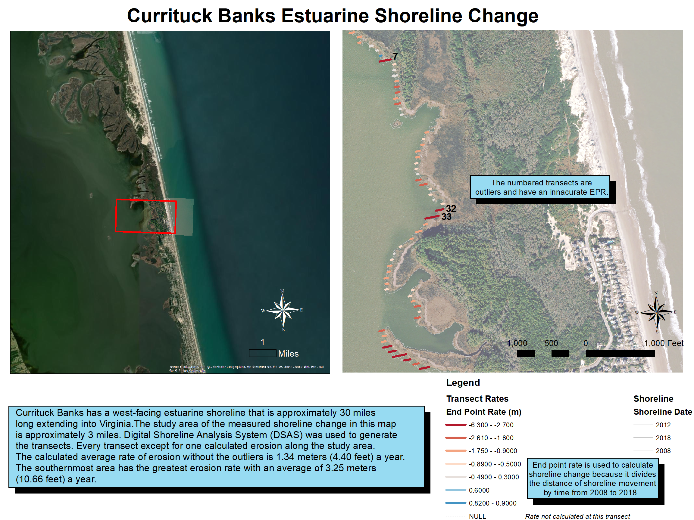
I was tasked to use past and find my own GIS data to calculate erosion rates on the sound and ocean side of the Currituck Banks Reserve. This reserve is one of three that was managed by Jason including Buxton Woods and Kitty Hawk. Unfortunately, Jason moved jobs to Raleigh very early into my internship so I never got to meet him. However, he still helped guide me with the many GIS problems that ultimately arise with any project. I know GIS is not for everyone, but I wholeheartedly believe the common cliche that a picture is worth a thousand words. In my case, I am able to use maps to show information and data in a much more creative and intuitive way than the inferior graph.
I learned that working with a GIS system such as ArcMap uses a lot of problem-solving. Anyone who has used GIS or really any computer-based software knows that problem-solving is a very useful skill in data analysis. There were many problems that came up with using a new shoreline analysis extension that I have had no previous experience with, but my mentor Jason was always by his phone with great advice.
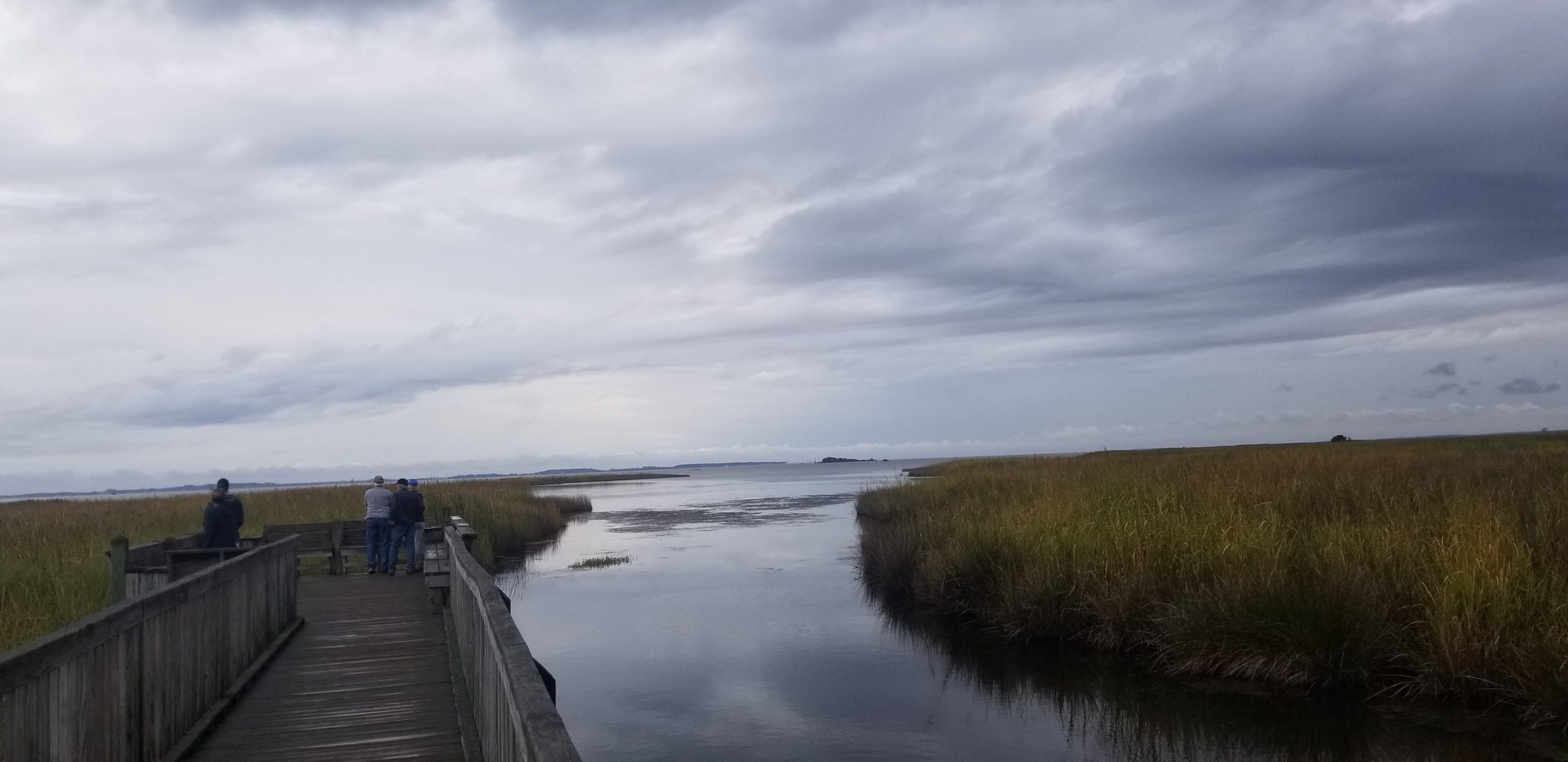
Jason along with my classes this semester have taught me the importance of marshes for the estuarine ecosystems. Marshes have been studied extensively and is a key wetland ecosystem because they can help grow in elevation with sea level rise, slow shoreline erosion, and improve water quality. I am glad that I was able to map erosion rates over a 10 year period for the sound and ocean (but also saddened that the whole estuarine study area in Currituck Banks is eroding).
I am very happy with my role in the internship as well as the capstone to be able to use GIS and make maps that have real world implications. Since there is no current northern sites manager, my results for the internship will be sent to the research director in Beaufort, NC. It will be used as a basis for locations of future marsh restoration projects in the Currituck Banks Reserve.
My time at the OBX and UNC as a whole is coming to an end very soon. I do not think it has hit me yet, but boy am I glad to be doing class outside every day and interning for the DCM instead of ending it with a full semester of online class. I will probably spend the rest of the night applying for more jobs in the triangle area with the help of this internship tying a perfect bow on my ecology restoration experience.