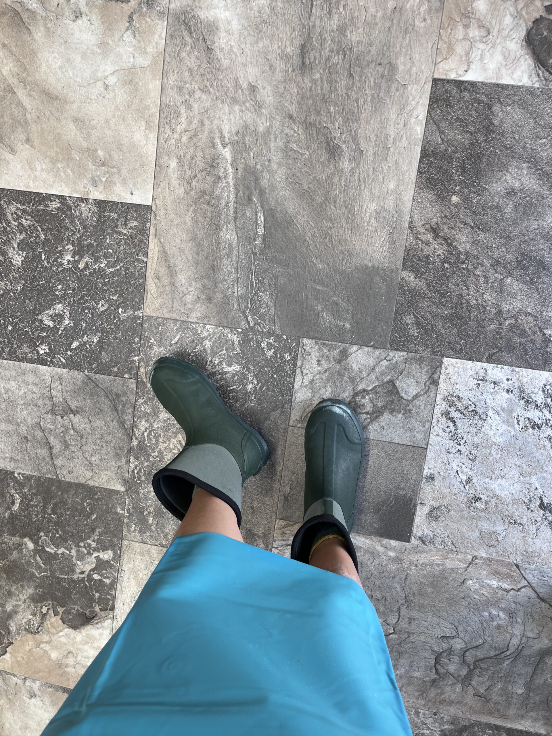
This semester, I (Julia Elliott) interned with the National Park Service at the Cape Hatteras National Seashore. Since UNC is giving us course credit for our internships, I tried to imagine what the syllabus would look like: go to the beach at sunrise, admire turtle hatchlings, make friends with Park Rangers, and learn a heck ton about the seashore. Quiz questions include, but are not limited to: how to tear open an undeveloped turtle egg without having it spray onto your face, how to walk up old lighthouse stairs with marshmallow feet, and how NOT to get a deceased dolphin stuck in the walk-in freezer. Welcome to the UNC course, ENEC 395: Bridges in the Outer Banks, taught by Professor Doshkov and Professor Gosselin.

Bridges
To get to the Outer Banks, one must cross a series of bridges. They extend over rivers, sounds, and inlets. Like the bridges that connect shifting barrier islands, there are also bridges connecting both ecological processes within ecosystems, and people within society. I traversed these various bridges with Mike Gosselin and Paul Doshkov, and numerous others, nearly twice a week for the past three months.
Physical
We frequently passed over the Bonner and Jughandle bridges to access various on-ramps to the beach. As far as I could tell, Oregon Inlet lived up to its name as one of the most dangerous inlets on the East Coast. Passing over it twice a week allowed me to assess its ever-changing nature; some days it was calm, others I could’ve washed my clothes in the washing machine-like waters. Like the waters underneath the bridge, the traffic pattern was constantly changing as construction workers reworked different sections. Despite all these seemingly perpetual changes, Great Black-Backed Gulls and Lesser Black-Backed Gulls (both valued equally) always lined the railings, and the road, as we traveled South in National Park trucks, sea-sprayed and shaking from the grains of sand on the purposefully deflated tires. Physically traversing the bridges was not my only experience with them; I traversed through their history in the archives at Fort Raleigh. Working with Jami Lanier, I leafed through hundreds of documents about the construction of both bridges, from Environmental Impact Statements to correspondences concerned about various related issues. I saw pictures of the various stages of planning and building, giving me an extra appreciation for the amount of work it takes to build any structure, but especially miles-long bridges spanning tempestuous waters and connecting vulnerable islands (and strong enough to hold all those pesky gulls, of course).
Social
This increased appreciation for bridge architecture and city planning comes with an increased appreciation for social bridges, as well. As someone who grew up in various medium to large-sized cities, the more tight-knit community of the Outer Banks has never failed to impress me.
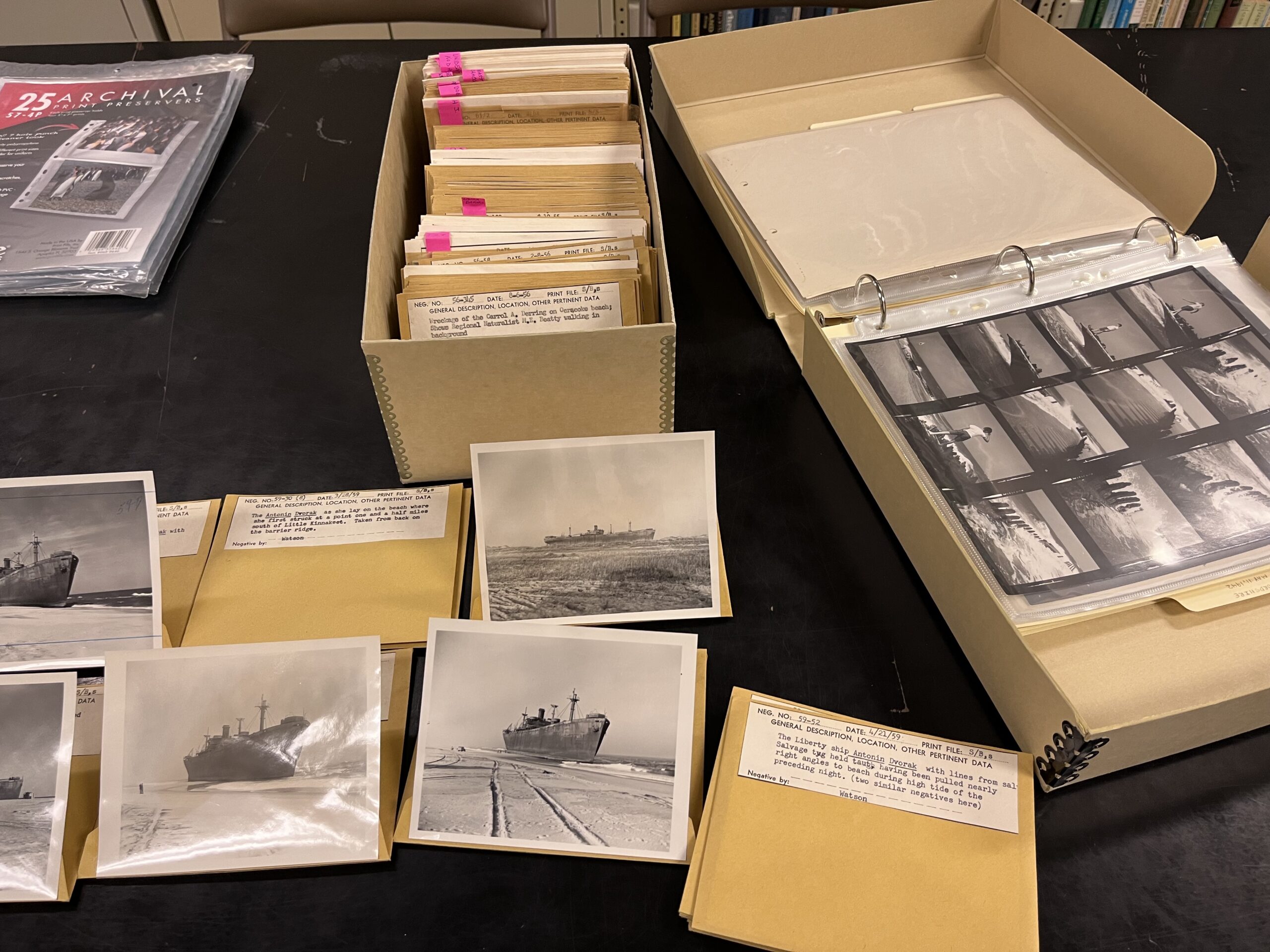
I’ll provide an example. I was sitting in the archives in Fort Raleigh, creeping up on hour four of organizing and identifying shipwreck photos. My initial excitement at the age of some of these documents was wearing off as my post-lunch dreariness began to kick in. I picked up a photo of a huge ship on the beach, wondering how the captain managed to strand a WW2 era battleship. I flipped over the dated photo to see who had taken it, and to my surprise, I recognized the name! Michael Halminski, a well-known name in the Outer Banks, had taken the photo in the ‘70s. He had come up many times in my conversations with my journalism-and-photography-inclined classmate, Emmy.
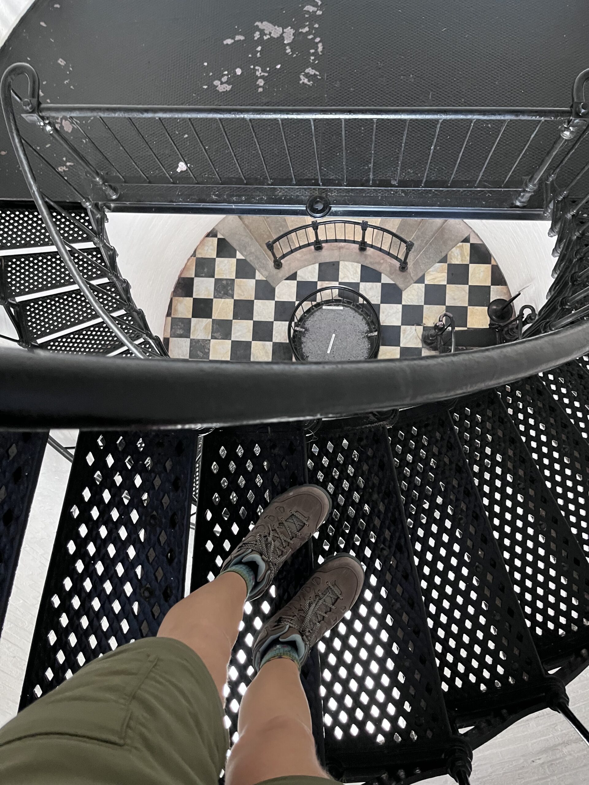
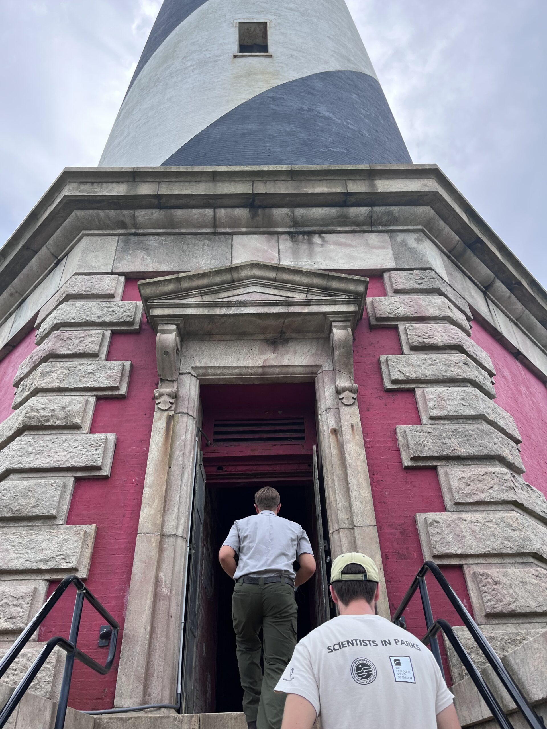
Similarly, on the second day of my internship, I drove an hour and a half south to the Cape Hatteras lighthouse. I went down there to meet Michael Flynn and Kegan Kleeschulte, who were surveying the inside of the lighthouse for a restoration project. I apprehensively hopped the fence keeping the public from entering the lighthouse, and met them for the first time. Michael expressed knowing Quinn – “What’s her name? Gwen?” – one of my fellow classmates. His wife, Alyson, was Quinn’s internship mentor. The connections thus continued. Perhaps this is a very common occurrence and a natural part of life for those who call small communities home. But for me, slowly building these bridges between seemingly unrelated people I met allowed me to feel like a part of the Outer Banks network.

Ecologically Educational
I also built many bridges between the themes of my classes at the Coastal Studies Institute and the things I saw from the NPS truck window. In Coastal Ecology, for example, I learned about ghost crabs and their importance as an indicator species. The next morning on the beach, I saw the effects of ghost crab predation on sea turtle nests as the sun rose behind me. In Coastal Law and Policy, we learned about the North Carolina laws limiting erosion control measures on the beach, which was difficult to understand after continually driving by steep, eroded escarpments. I was able to ask the town commissioner of Nag’s Head about the exposed septic tanks in Rodanthe after spending a morning with Mike filling the bed of our truck with PVC pipes and heavy wedges of wood from brand new stairs that had collapsed. I spent another morning with Paul taking photos of pieces of tar paper, carpet, and insulation that was still washing up onshore, months after the houses had fallen into the ocean. They work hard to clean up the mess caused by insurance companies’ policies allowing homeowners to collect insurance only after the houses collapse into the ocean.
In my opinion, this is what college should be – having the opportunity to bridge the gap between valuable theoretical knowledge and hands-on, real-world experiences.
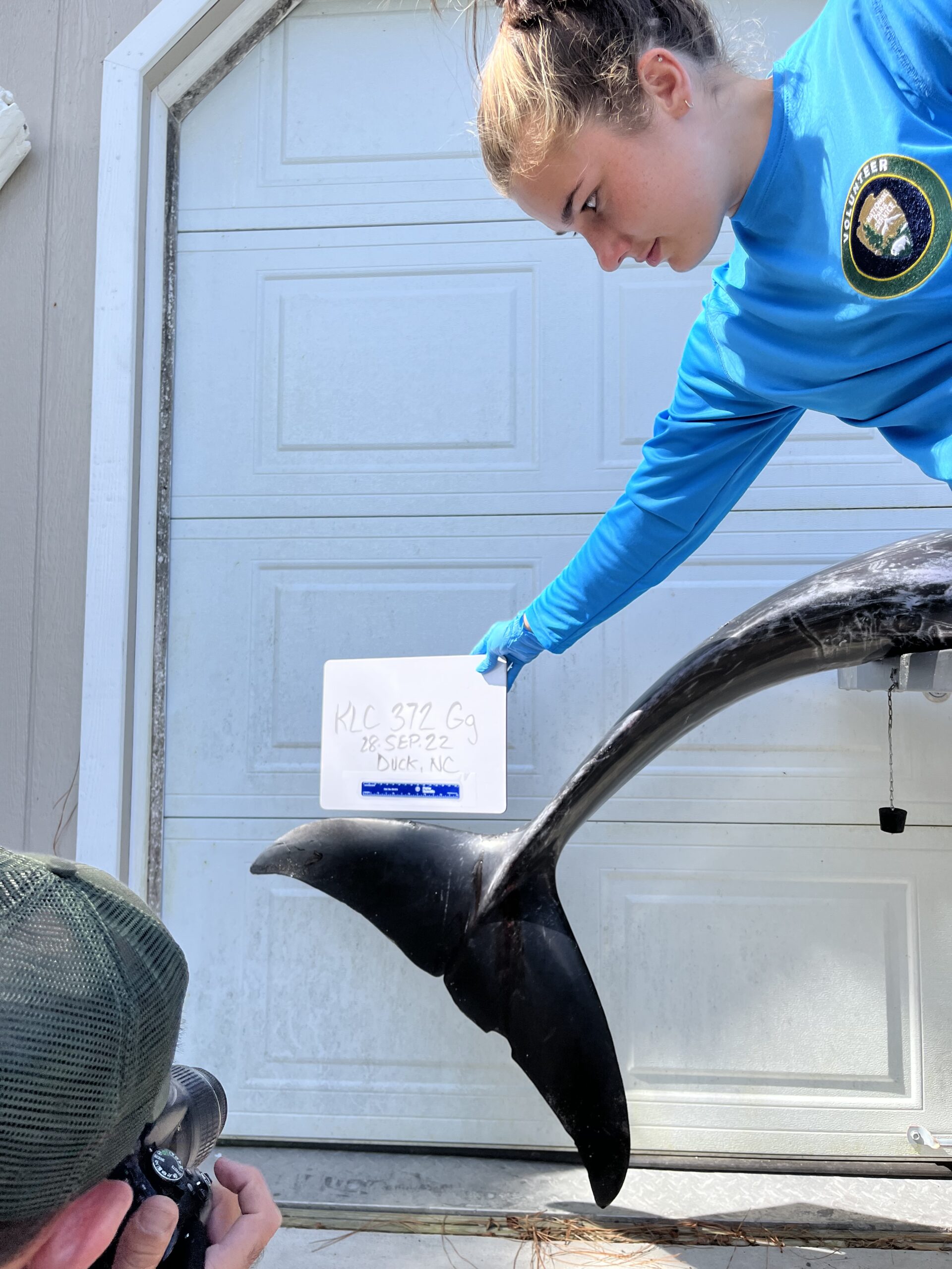
Another aspect of my internship was assisting in marine mammal strandings. A few of my classmates jokingly expressed concern at the level of enjoyment I derived from necropsies, or animal autopsies. It got to the point where Paul was saving stranded turtles in the fridge for me to help necropsy (thanks Paul!). My fascination was not innately morbid, and came only after a brief reflection on and appreciation for the life it had lived. After these considerations, I was engrossed in the process. Watching Paul and the stranding coordinator, Marina (who also happens to be Paul’s wife – another bridge!), expertly perform a necropsy on an adult Risso’s dolphin was an experience I will never forget. I can’t describe the inside of the dolphin as anything other than beautiful – the colors of the organs, the squiggly lines of the veins, the connection of the lungs to the blowhole… it was like an entire universe, complete with its own planets and constellations, lived inside of this dolphin. Every part of its body was connected by various bridges, just like every function the dolphin provided to its environment helped bridge an ecosystem together.

Willet, or won’t it? (…credit to Paul on that one)
I’d like to add a few more random tidbits (perhaps some pieces that fell off of my metaphorical bridge) that I feel encompass my time with the National Park Service:
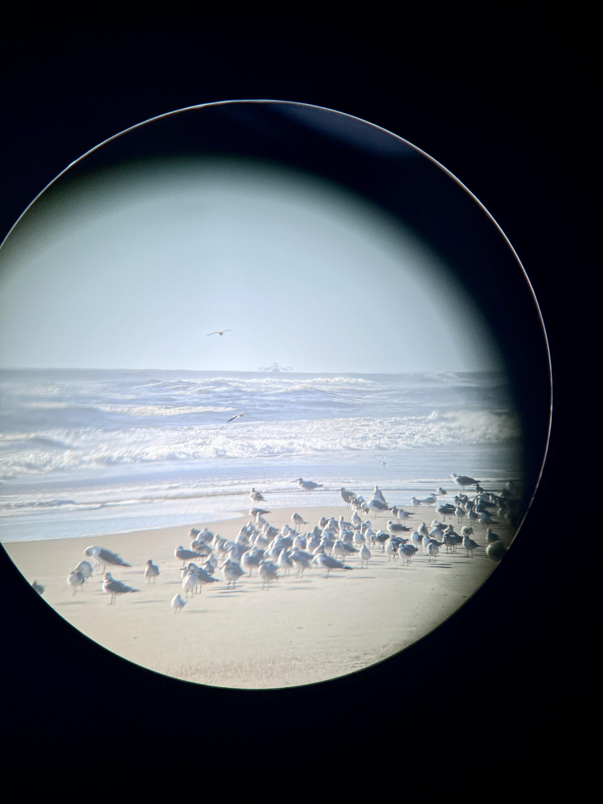
I learned a lot of new birds. Willets, Sanderlings, Plovers, Cormorants, my two personal favorites, Terns and Ruddy Turnstones, to name a few. Paul told me about four-letter bird codes, which helps when documenting location and activity of certain birds. American Oystercatchers are AMOY, Piping Plovers are PIPL, Paul Doshkov is PADO, Julia Elliott is JUEL. My Toyota Yaris is TOYA. I gave all of my roommates their four-letter bird codes, too.
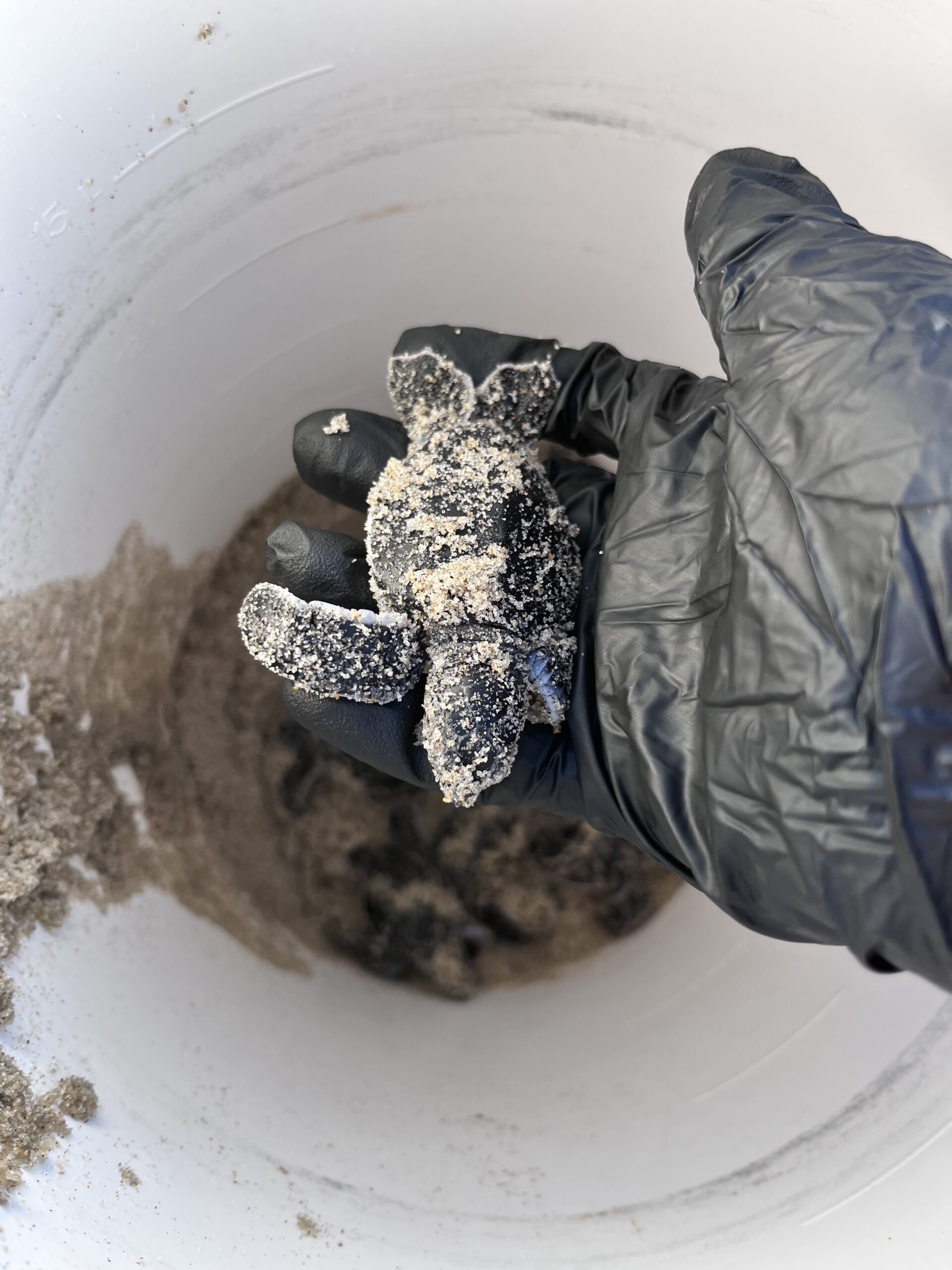
I could go on about the valuable things I saw and learned during my three months working on the Seashore. I got to see the way the beach changed on a day-to-day basis – how the impact of Hurricanes Ian and Nicole affected both the shape of the beach and the turtle nests. I worked first hand with sea turtle nests and turtle hatchlings (which I have written surprisingly little about, despite it being an important and rewarding part of the job). I learned how to get up ridiculously early (4:30am on some days), and what it was like to truly be valued and respected in a job position. I want to thank Kegan, Jami, Michael, and many other Park Service employees for their kindness and patience. Mike and Paul – you both have truly made my experience in the Outer Banks one to remember. And thanks to Lindsay and Linda for accepting my request to work with the Park Service – it’s been great! Time to keep building my bridge towards the next adventure.